cable not compatible?
 |
15 years
|
I think I noticed a thread somewhere on POI Factory about this but can't find it ....
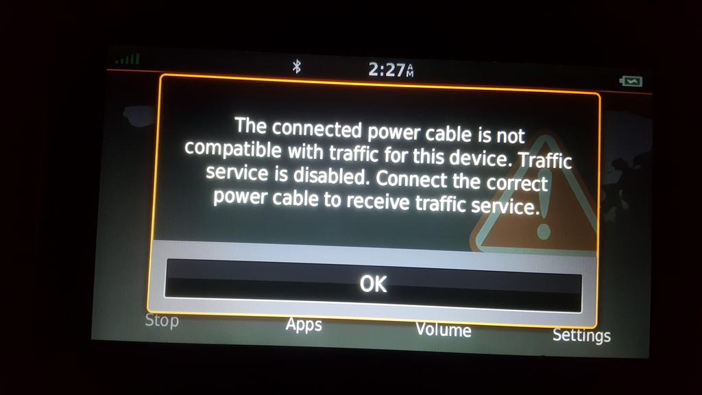
https://s7.postimg.cc/ensa7o5ln/20180522_022736.jpg
The above link is a screenshot of my Nuvi 2689 advising me that my power cable is not traffic compatible. This notice just appeared today, I use this cable with this GPS everyday, even when not planning a route I have it on, same cable, same GPS, traffic has always worked fine, for while last year I was even using the Garmin smartphone link also with traffic. I dropped the smartphone app as it was draining the battery looking for the device when I wasn't using it ... anyway that's another story.
Why am I all of a sudden getting basically an error message on a power cable I've been using since I got the GPS, it came with it? Other than the traffic it works fine keeping the GPS powered up.
.
I'm just wondering, if one is using the smartphone link app, why not just use google maps or waze in the first place?
Being crowdsourced, I'd imagine google maps/waze traffic to be about as real time/accurate as it gets. How well does the smartlink app mirror google maps traffic reports?
I've never used waze and have only used Google maps while not moving to look something up and get an idea of the area.
That said I've read the waze can often be fed the wrong info on purpose, mainly by police trying to hide where they are.
I can tell you this about my Garmin with the smartphone link. Today I was going to the same location several times, I was semi familiar with the trip but programmed the address of both ends in the GPS anyway. One of the "to" trips I noticed the return side was backed up because they were fixing the guide rail in the median.
Well for the return trip I programmed in the location and it was going to take me the same way back. Not knowing the surrounding area I went with the route. About 5 miles before the traffic jam I heard the GPS tell me it added 8 minutes to my trip and I was taking the fastest route. As I got very close to the beginning of the jam the GPS was telling me to take the next exit, I was reluctant but did.
Now this is the amazing part, the GPS detoured me around the jam by putting me on a road literally right next to the highway, only separated by a high curb, I could see all the traffic I was bypassing on this nearly empty road right next to the highway and it told me to get back on the highway about 100 yards past the end of the construction zone.
Pretty good in MHO.
I don't know if I'm using the link the way it should be, or the difference in using Google maps on my phone and the link in concert with my GPS data wise, but I like the GPS it's nearly 7 inches big and I can still use my phone as a phone if I had to without losing the map for the moment.
. 2 Garmin DriveSmart 61 LMT-S, Nuvi 2689, 2 Nuvi 2460, Uniden R3 radar detector with GPS built in, includes RLC info. Uconnect 430N Garmin based, built into my Jeep. .
^^That's mighty useful. On
^^That's mighty useful. On long road trips I'll usually check traffic on the phone at each stop (~90-120 minutes). I agree, that gives me a snap shot at that moment and things can change by the time I get there.
I'll give this a shot next time we're headed somewhere unfamiliar. Locally, there's always traffic (in chicago), so it's not that I don't know how to get to where i'm going but some streets may have heavier traffic than others, that's where google/waze come in handy.
Here's typical 4pm tuesday afternoon chicago traffic - https://i.imgur.com/o0uc7e3.png . The 90/94 is to be avoided until either becomes a toll road, then it's wide open.
Google traffic vs Garmin Smartphone Link
~snip~
In general, I prefer the way Garmin Smartphone Link displays information over Google, but both are acceptable IMO. I suppose the accuracy at any given time depends on the number of active users on the given system at that specific place and time.
I'm confused, are you using a Garmin with the smartphone link or your phone with Google maps with the smartphone link?
My new DS 61 says it's connected to the smartphone link but I don't look at the phone at all, just the GPS, I'm guessing the info from the link is being fed to the GPS via the bluetooth?
Sorry for the confusion. Android Auto uses your smartphone Google Maps app for navigation and traffic, but displays on your car's infotainment (radio) display. It connects to your smartphone via a USB cable. Your phone is doing all the work and running Google navigation, but it displays on your car's display screen. Garmin Smartphone Link is an app that runs on the smartphone and connects to your Garmin device through bluetooth to show Traffic and other information on the Garmin display.
As I said in the earlier message, I was surprised to discover that I could run both Android Auto Google navigation and Smartphone Link on my smartphone at the same time. But this allows me to compare the Google and Smartphone Link traffic services in real time, using the two different displays (the car infotainment display for Google maps/navigation/traffic, and the Garmin 3597 for Garmin navigation/Smartphone Link traffic). It is really pretty cool to observe it and see the differences between the two systems.
I hope that clears it up. If I get a chance sometime, I will take a picture (with a digital camera) of both systems and post it.
Alan - Android Auto, DriveLuxe 51LMT-S, DriveLuxe 50LMTHD, Nuvi 3597LMTHD, Oregon 550T, Nuvi 855, Nuvi 755T, Lowrance Endura Sierra, Bosch Nyon