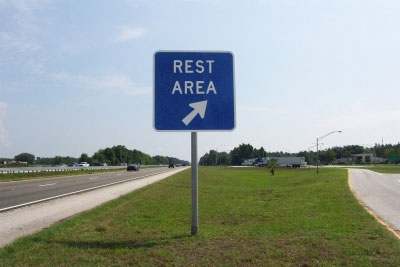
Rest Areas Combined-USA
Login or register to download files
Raw file: RestAreasCombined_USA.csv (281.67 KB)
Includes 3032 locations in the following areas:
- United States: AK, AL, AR, AZ, CA, CO, CT, DE, FL, GA, IA, ID, IL, IN, KS, KY, LA, MA, MD, ME, MI, MN, MO, MS, MT, NC, ND, NE, NH, NJ, NM, NV, NY, OH, OK, OR, PA, RI, SC, SD, TN, TX, UT, VA, VT, WA, WI, WV, WY
- some may be in: AB, MB, MEX, NB, ON, QC, YT (near a border)
Regularly updated POI csv file for the combined rest areas in the lower 48 states. IT ALSO INCLUDES SOME AK LISTINGS. This file includes rest areas with restrooms as well as rest areas without restrooms, some truck comfort stations with restrooms, rest areas with scenic views, historical rest areas, turnouts, rest areas that are under construction, etc.
(A file with ONLY Rest Areas with Restrooms is linked below.)
NOTE
The data in Column C and in Column D, has been configured in a manner that allows sorting on the following:
- Column C can be sorted by State, Highway and Direction of travel.
- Column D can be sorted by which facility is wanted. RR, PT, VM, Pets, HF, Misc (includes RV Dump,Phones,Scenic views,etc) I believe most users would sort on RR, however,this will not be necessary since there is now a file listing only those locations that have restroooms.
This tutorial outlines some of the nomenclatures used in the combined list of rest areas in the lower 48 states.
The coordinates shown, in the great majority, are the coordinates for the entrance to the "location" off ramp.
#1 "Locations" are Rest Areas, Welcome Centers, Service Plazas or Turnouts. Every attempt was made to get the off ramp entrances for both directions of travel on a highway.
#2 The message shown on the GPSr will typically be "CA,I-5,SB,WILLOWS REST AREA, MM608" with the expanded information (COLUMN D) typically "RR, PT, VM, Pets, HF" where : RR=Rest Rooms,RR(PP)Portapotties, RR(VT)Vault Toilet, PT=Picnic Tables, VM=Vending Machines, Pets=Pet Walking Area, HF=Handicapped Facilities, RV Dump=self explanatory, Food=a restaurant of some sort, Gas= available, MM=Mile Marker (NT)=No Trucks, WIM=weigh in
motion.
#3 If the location has RR it has,in most cases, phones available
#4 If the location is located in the center or median strip of the highway this will be shown as "FL,FL TP,NB,SNAPPER CREEK SERVICE PLAZA LEFT EXIT, MM19" to allow time to get in proper lane.
#5 In many cases, the location will not be directly off the highway. This will be show as "AZ,I-40,WB,PAINTED CLIFFS WELCOME CENTER FOLLOW SIGNS, MM358" If any of these locations are significantly off the highway or in an area with cross highway/streets, additional coordinates are provided and these are placed at the target
destination. These are noted with the word "ADDRESS" in column C.
One recommendation: When you set the proximity alert for this file - do yourself a favor - set the alert for 1-2 miles to give yourself ample time to get into the correct lane with ease & safety.
Credit for the original file goes to Retired Technician (RT) and also for his POI Verifier software which caught (and still catches) input errors. Thanks RT! A special thanks also goes to MrKenFL for all the time and effort he put in to maintaining this file for 8 years. Thanks MrKenFL!
Icons
- Outhouse 48 BMP Icon
- Outhouse BMP Icon
- Rest Areas 1 BMP Icon
- Rest Areas 2 BMP Icon
- Rest Areas 3 BMP Icon
- Rest Areas 4 BMP Icon
Sounds
See also
Discussion Topics
Change History
mahoney - Apr 12, 2026
Updated the filemahoney - Jan 8, 2026
Updated the file.mahoney - Oct 27, 2025
Updated the listing for those rest areas that do not have rest rooms.Plornch - Sep 20, 2025
The Centerville, Indiana welcome center on I-70 westbound is closed (MM 144). It appears that they are constructing a new buildtcreek - Sep 7, 2025
The scenic view turnouts on I-40, NM, MM 113 are closed. Access roads have been removed.mahoney - Aug 25, 2025
CO I-25 both of the Pueblo Rest Areas NB (mm 115) and SB (mm 112) are closed IndefinitelyPlornch - Aug 8, 2025
Submitted the status for the I-75 rest areas in Ohio.Plornch - Aug 8, 2025
Submitted an article regarding Closures of I-75 interstate in Ohio. See article in the Rest Area-USA Discussion pagedated 8/8/25mahoney - Jul 24, 2025
Updated the file.mahoney - May 12, 2025
Updated the file.Plornch - Feb 11, 2025
The rest areas (2) on US-23 in Marion County,OH have reopened.mahoney - Dec 18, 2024
Updated the file.mahoney - Sep 23, 2024
See Rest Area USA Discussion for changemahoney - Aug 26, 2024
See rest area discussion page for changemahoney - Jul 9, 2024
SR 299,CA,Moon Lim Lee Rest Area EB and WB-reopened and US 101,CA,Camp Roberts Rest Area NB and SB-reopeneddavecantor - Jul 1, 2024
CT,I-95,NB,TOURIST INFO REST AREA, MM65.5 has reopened.mahoney - Jun 23, 2024
Additional closures in Ohio-See discussion Page dated 6/23/24 for details.mahoney - May 1, 2024
Updated the status of the rest areas.mahoney - Mar 8, 2024
Corrected the coordinates for the Lost Trail Rest area, US 93, Suta,MT.Plornch - Jan 9, 2024
Submitted the closure of rest areas in Ohio. See the Rest Area USA Discussion thread dated 1/9/2024 for detailsmahoney - Dec 24, 2023
IL,I-55,NB,FUNKS GROVE REST AREA, MM149 is open.mahoney - Nov 26, 2023
Corrected the data for the Dizzy Dean Rest area on US 49.ScrappyCrow - Nov 26, 2023
Submitted a correction for the MS Welcome Center on US 49mahoney - Oct 17, 2023
Suwanee county rest area FL, I-10 EB, mm 294 is OPENmahoney - Oct 2, 2023
Updated the status of the rest areas.CaseyGuy - Aug 28, 2023
The Rest Area in WV on I-70, WB, MM13 is Temporarily Closed (Welcome Center)mahoney - Aug 7, 2023
Sunset Point Rest Area on I-17 in Arizona has reopened.mahoney - Aug 1, 2023
See rest area discussion for changesJanJ - Jun 17, 2023
Submitted a note that all Rest Areas on I-65 in Indiana are Closed.mahoney - Jun 11, 2023
Updated the status of the rest areas.tcreek - May 12, 2023
Noted that the Trail of Tears Rest Areas, I-57, IL,MM 32 are CLOSEDmahoney - Mar 27, 2023
Websites shows ALL rest areas on I-5 in California are open.mahoney - Mar 1, 2023
Updated the status of the Gaviota Rest Areas (NB/SB) and the Camp Roberts Rest Areas (NB/SB). These are located on Rt 101 In CAdavecantor - Feb 14, 2023
MA,I-95,SB,WEIGH STATION PARKING AREA,MM2.5 IS CLOSED. Maybe permanent.mahoney - Feb 10, 2023
Updated the status of the rest areas.mahoney - Jan 6, 2023
See comments in Rest Areas-USA Discussion dated 1/6/2023.TGblaisdell - Dec 25, 2022
See comment in Rest Areas-USA Discussion dated 12/25/2022.mahoney - Dec 20, 2022
File update.mahoney - Nov 2, 2022
Updated the status of the rest areas.mahoney - Sep 23, 2022
See Rest Area-USA Discussion for changes to AZ,I-17,NBSB Sunset Point Rest Areamahoney - Sep 5, 2022
Updated MIwildhog - Jul 22, 2022
Submitted 2 Closed rest areas on MS I-55 MM202 NB and MM204 SB.These 2 parking rest areas did not have restrooms.mahoney - Jun 5, 2022
Updated the open/close status of some of the rest areas.mahoney - Apr 26, 2022
Forum topic:Rest Areas-USA Discussion For changes see page 5, Date of changes 4/19/2022rexdee - Apr 18, 2022
Note: The Davis Rest Area on OK, I-35,MM 59 has closed permanently. No final word on the SB rest area.TGblaisdell - Mar 13, 2022
See discussion pages for changesmahoney - Feb 21, 2022
See discussion page for changesdavecantor - Jan 19, 2022
Noted:The rest area at CT,I-95,NB,TOURIST INFO REST AREA, MM65.5 HAS BARRIERS AT ENTRANCE. NO ETOmahoney - Dec 16, 2021
See the Rest Area-USA Discussion Forum, dated 12/16/2021Plornch - Dec 6, 2021
The rest area at IL,I-39,SB,WILLOW CREEK REST AREA, MM84 is open.mahoney - Oct 25, 2021
Updated the open/close status of some of the rest areas.mahoney - Sep 7, 2021
See Discussion page for changes.barrettjl - Aug 14, 2021
Noted that the coordinates for the NB I-35 NB, Bell County Rest area were incorrect.mahoney - Jul 30, 2021
Updated the open/closed status of rest areas in CA and FL.jzarick - May 25, 2021
For details see Rest Areas-USA Discussion threadmahoney - Apr 29, 2021
Updated the BUTTE LA ROSE REST AREA listing. See the rest area-discussion thread for details.haroldv - Apr 29, 2021
Noted that The LA,I-10,EB,BUTTE LA ROSE REST AREA FOLLOW SIGNS, MM122 30.34267, -91.7218 should be WBrueterd - Apr 6, 2021
Noted that the Crystal Springs Rest area in NV 318/375 does not have restroomsmahoney - Mar 1, 2021
See the Rest Areas-USA Discussion topic for the additions.rueterd - Feb 21, 2021
Submitted the correct spelling for the Ellmaker State Park in Oregon and also the fact that this rest area has flush toilets.rexdee - Feb 10, 2021
Submitted the correct coordinates for the TX,I-35,SB,GAINESVILLE TRAVEL INFORMATION CENTER, MM502 rest areamahoney - Jan 18, 2021
Updated Column D information. Rest Areas facility availabilities.mahoney - Dec 10, 2020
Updated the file. See rest area discussion thread for details.mahoney - Nov 17, 2020
Updated the status of the TN interstate rest areas and added the I-81 jefferson county rest area MM2.mahoney - Oct 26, 2020
Updated the Massachusetts Rest Areas on I-495.mahoney - Oct 6, 2020
See rest area discussion for changesmahoney - Sep 15, 2020
Updated the open/closed status of the rest areas.barrettjl - Aug 13, 2020
Submitted 2 TX closed rest areas-See Rest Areas-USA Discussion for changesmahoney - Aug 3, 2020
See Rest Areas-USA Discussion for changes. Dated 8/3/2020barrettjl - Jul 28, 2020
Submitted the correct coord for the TX,I-35 Hill County Rest Areasliferebooted - Jul 22, 2020
Submitted the Closed rest area, OK,I-40,EB,SHAWNEE REST AREA,MM197mahoney - Jun 19, 2020
Updated/verified the open/closed status for the interstate rest areas.mahoney - May 16, 2020
See the discussion thread for the details.mahoney - Apr 7, 2020
See the rest areas-usa discussion thread for the details.mahoney - Mar 3, 2020
See the rest areas-usa discussion thread for the details.TGblaisdell - Feb 12, 2020
Submitted the correct coord for the FL,I-75,SB,Collier County Rest Area.mahoney - Jan 27, 2020
Added Brothers Oasis Rest area in OR, Dodge Junction Rest area in WA and Bridger Rest area in MT.mahoney - Jan 9, 2020
SEE THE REST AREAS-USA DISCUSSION THREAD FOR THE CHANGE, DATED 1/9/2020.mahoney - Dec 23, 2019
Updated the file. See the REST AREA-USA DISCUSSION THREAD FOR THE DETAILS.mahoney - Dec 13, 2019
Added Timmerman Rest area on US-75 in Idaho.mahoney - Nov 18, 2019
Added a listing of rest areas along US-101 in Oregon.mahoney - Oct 20, 2019
Added the Kingsport Welcome center on TN, I-26, EB/WB, MM5rueterd - Oct 14, 2019
Submitted the Elmaker State Park Rest Area on US-20 in Oregon.lacanadio - Sep 26, 2019
Submitted a number of punctuation corrections.davecantor - Sep 26, 2019
RI,I-295,NB. This rest area is open. However, the Tourist Info Center is closed. RR(PP) are available.davecantor - Sep 24, 2019
CT,I-95,NB Tourist info rest area MM65.5 has reopened.mahoney - Sep 20, 2019
The Morgan county and the Columbia county rest areas will not reopen until at least 10/4/2019mahoney - Aug 16, 2019
Updated the open/closed status of the CA Interstate Rest Areasmahoney - Aug 10, 2019
Added the definition of RR(PP) Portapotties and RR(VT) Vault Toilet in the description/Aagaard01 - Aug 5, 2019
Noted that the Canoa Ranch Rest Areas on I-19 in Arizona have reopened.davecantor - Aug 4, 2019
Submitted 2 changes. See Rest Areas-USA Discussion thread for specificsPlornch - Jul 30, 2019
Noted that the rest area on IL, I-39,NB,MM84 has reopened. Also, OH,I-70 WB, verified that is appears to be closed permanently.mahoney - Jul 11, 2019
Changes made to the Illinois Interstate Rest Areas. See the Rest Areas-USA Discussion thread for the changes.mahoney - Jun 30, 2019
Additional changes were made. See the thread for the "Rest Areas-USA discussion" dated 6/30/19 for the details.maddog67 - Jun 30, 2019
I-71 Warren County rest areas in Ohio are open. In addition the I-70 WB MM3 is probably closed permanently.mahoney - Jun 28, 2019
Updated the status for the interstate rest areas in GAmahoney - May 25, 2019
Iredell county rest area on I-77, NC, MM58 is located in the median between the NB and SB lanes. I added the words "LEFT EXIT" .mahoney - May 13, 2019
Adjusted the coord for the 2 scenic overlooks on I-26 in TN.mahoney - Apr 29, 2019
UpdatedImpala64 - Feb 27, 2019
Noted: The rest area GA,I-75,SB,Monroe County Rest Ares ,MM 179 is Open.mahoney - Feb 24, 2019
Updated the status of Interstate rest areas.charlesd45 - Dec 30, 2018
The I-10 Rest areas both EB and WB at MM133 in Florida are closed. (Jackson County)mahoney - Dec 18, 2018
Updated the open/closed status of some rest areas.mahoney - Nov 16, 2018
Added the Rangely (BLM) rest area in CO.MikeG1 - Oct 17, 2018
Noted that the I-80 Rest Areas (Salt Flats and Grassy Mountain) located in Utah have flush toilets.mahoney - Oct 7, 2018
Updated the GA interstate rest areas to the latest GDOT listing.ratjumper - Sep 19, 2018
Noted that the NB and SB rest areas on I-81 MM132 in PA are Weigh Stations and not turnoutsmahoney - Sep 12, 2018
According to GDOT the rest area on I-475 NB, in GA has reopened today.Impala64 - Aug 25, 2018
With the exception of I-475 NB rest area and I-75SB,MM179 rest area, all GA interstate rest areas are Open.Plornch - Aug 7, 2018
Noted: The Preble County rest areas, both EB and WB on I-70 in Ohio are CLOSED.(MM3)mahoney - Jul 24, 2018
Cook County Rest areas (NB and SB) on I-75 in GA have reopened..mahoney - Jun 15, 2018
Corrected a few coordinates.mahoney - May 28, 2018
Corrected the coordinates for the US19/74 Andrews rest area in NC. Also added 3 new locations in Tx without RR.maddog67 - May 22, 2018
Noted that the Warren Rest Areas (both NB and SB) are closed for rebuilding. OH,I-71, MM34SteveR - May 21, 2018
Submitted comments regarding the Haywood County Rest Areas in NC.Bob.Sedona - May 14, 2018
Noted that the WB Sacaton rest area, I-10 MM182 in Arizona is closed at this time.Bob.Sedona - May 12, 2018
The San Simon rest area, both eb and wb, are back in service. These are in AZ on I-10, MM388mahoney - Apr 27, 2018
Updated the rest areas in ND.CraigW - Apr 16, 2018
Submitted Blanding,UT Visitor Center.TGblaisdell - Apr 13, 2018
Noted a new rest area on I-77 in NC. This replaces 4 other rest areas along this stretch of I-77.mahoney - Apr 2, 2018
Indian Nation TP-Oklahoma. Added the McAlester Service Plaza and removed the Antlers and Eufala Service Plazas.mahoney - Mar 29, 2018
Added 4 rest/picnic areas in TX, No restrooms.Bob.Sedona - Mar 12, 2018
Submitted coord for the new off ramp leading to the Fl turnpike Snapper Creek Service Plaza, traveling northbound.kusuriurikun - Mar 12, 2018
Noted that the Beaver Dam Service Plaza in KY has reopened.mahoney - Mar 3, 2018
White River Rest Area in Arkansas has reopened.mahoney - Feb 21, 2018
Updated the file.Impala64 - Jan 29, 2018
Updated the status of rest areas along I-75/475 in GA.mahoney - Jan 24, 2018
Updated the rest area information in northeast Wyoming and added 5 new locations.kurzemnieks - Dec 31, 2017
Noted that the CA,I-10,WB CACTUS CITY REST AREA AND BOTH THE EB AND WB WHITEWATER REST AREAS have closed againBCfromKY - Dec 23, 2017
Submitted the TN,I-24,EB,NICKAJACK REST AREA, MM160mahoney - Dec 20, 2017
The GA rest areas in Laurens (I-16) and Glynn (I-95) counties have reopened.kurzemnieks - Dec 7, 2017
Noted that the CA,I-10,WB CACTUS CITY REST AREA AND BOTH THE EB AND WB WHITEWATER REST AREAS ARE OPEN.mahoney - Dec 5, 2017
Updated the status of the IN I-80/90 travel plazas.mahoney - Dec 3, 2017
Added rest areas along TX-385. Picnic/rest areas, no restrooms.mahoney - Nov 17, 2017
Added 6 picnic/rest areas in TX. These do not have restrooms.davecantor - Nov 10, 2017
Noted that the the icon did not show on his GPS. Checking, I found that I had the coordinates listed incorrectlyBob.Sedona - Nov 2, 2017
Submitted 2 closed rest areas. TX,I-40,EB And WB,Picnic/Parking,MM173. Neither of these have restrooms.mahoney - Nov 1, 2017
The EB and WB Pajarito Rest areas on NM I-40 at MM 302 are both closed.davecantor - Oct 23, 2017
Turnout located at RI,I-95,SB, Turnout is closed until Dec.2018mahoney - Oct 23, 2017
Added additional rest areas.mahoney - Sep 27, 2017
Updated the open/closed status for a number of rest areas.kusuriurikun - Aug 28, 2017
Noted that the Beaver Dam Service Plaza in KY is closed for renovation.TXRVer - Aug 24, 2017
Submitted 3 new rest areas with restrooms and 1 without in Me.mahoney - Aug 16, 2017
Corrected the wifi status for the rest areas in Tx.roundpub - Aug 16, 2017
Submitted changes to the file. See the Rest Area USA discussion thread.TXRVer - Aug 7, 2017
Noted that the Pride of the Prairei rest areas in Illinois have reopened. Also submitted 2 parking/picnic rest areas in texas.roundpub - Aug 4, 2017
Submitted 2 deletions for rest areas on I-40 in OK.aslaksonal - Aug 4, 2017
Submitted changes for rest areas in MT,WA and WY.mahoney - Jun 26, 2017
Updated the status of a number of locations and also added 8 new locations.mahoney - Jun 21, 2017
Rest area on SC,I-77,SB,MM66 has reopened. Also updated rest area data for Missouri.JanJ - Jun 21, 2017
Submitted Rest areas on SC,I-26,WB and EB,MM123mahoney - Jun 20, 2017
KY,I-65,SB,HART COUNTY REST AREA, MM60 has reopened.maddog67 - Jun 11, 2017
Noted that the OH,I-71,SB,Warren Rest Area has reopened.BCfromKY - Jun 9, 2017
Noted:The rest areas on MO,I-70, EB, mm 167 & WB,mm 169 are truck parking with NO facilities.mahoney - May 19, 2017
Updated the status of the CA interstate rest areas.mahoney - May 7, 2017
Updated the status of the GA I-75 interstate rest areasmahoney - Apr 3, 2017
Updated the status of the Georgia interstate rest areas.JanJ - Mar 21, 2017
Noted a problem with the coordinates for the KY, I-64 EB Rest area at MM 29.mahoney - Feb 28, 2017
Updated the file.JustinCase380 - Feb 14, 2017
Aided in establishing the correct coord for an alert for the I-10 TX EB welcome center MM1 rest area.mahoney - Jan 10, 2017
Added 6 County Picnic/Rest areas in Texas along US 84. None of these have restrooms.maddog67 - Dec 24, 2016
Noted that the Warren Rest Area, I-71,OH,NB MM34 has reopenedmahoney - Dec 22, 2016
See the note titled RV Travelers in the Rest Areas-USA discussion thread for the rest areas added.jollywally - Dec 19, 2016
Submitted the correct coord for the Elkhart Rest areas on I-35 in Iowa.MikeG1 - Dec 7, 2016
Noted that the Van Wert rest areas on US-30 in Ohio were missing from the file.jgermann - Dec 7, 2016
Submitted coordinates for the I-75 Tn NB welcome center to prevent an alert when traveling SB.mahoney - Dec 5, 2016
Updated the Closed/Open status of the rest areas in California.mahoney - Dec 4, 2016
Upgraded the status for the California I-10 rest areas.mahoney - Nov 19, 2016
Added Grand Bay Welcome center in AL and the Sumter county welcome center in AL is now open.TXRVer - Nov 19, 2016
TXRVer submitted 6 picnic/parkings areas, 3 in TX and 3 in NM. None of these have restrooms.TXRVer - Oct 30, 2016
Submitted 4 Picnic/Parking areas in TX and 1 in NM. None of these have restrooms.maddog67 - Oct 27, 2016
Noted that the Ohio warren rest areas MM34 on I-71 are closed. NB due to Jeremiah Bridge construction and SB for renovationmahoney - Oct 27, 2016
Added service plaza tourist information center on Rt-3 MA.mahoney - Oct 23, 2016
4 of the 8 travel plazas in Indiana are closed for reconstruction.mahoney - Oct 21, 2016
Added Welcome Center on I-495 Long Island Expressway and also 4 basicallly truck rest areas.davecantor - Oct 10, 2016
Submitted RR operating hours for some rest areas in CTTXRVer - Oct 3, 2016
Submitted 3 closed rest areas. 1 in OK and 2 in AR.davecantor - Sep 30, 2016
Submitted restricted hours for the CT North Stonington Rest Area Restrooms. 8am-4pmmahoney - Sep 22, 2016
Updated the MM numbers for the rest areas in CT using Google Earth.davecantor - Sep 22, 2016
Noted that the rest area in CT on I-95 at MM65.5 is closed. No est for reopening.davecantor - Sep 13, 2016
Submitted a reopened rest area on RI I-95 NB at MM6.2. Also corrected MM locations on NB and SB rest areas.mahoney - Sep 1, 2016
Added 6 new locations.bobinot - Aug 6, 2016
Submitted a picnic/parking area,no restrooms on US-24 in Illinois.mahoney - Jul 29, 2016
Added additional areas with restrooms.BCfromKY - Jun 29, 2016
Corrected the coord for the Gordon County Rest Area at GA I-75 SB, MM320TXRVer - Jun 22, 2016
Noted that the rest area on OK, I-35, NB at MM224 is closed.BCfromKY - Jun 19, 2016
Noted that the Hart County Rest Area located in KY on I-65 SB, MM60 is closed due to a fire.mahoney - May 24, 2016
Updated the status of the CA rest areasmahoney - May 20, 2016
Rest area on I-77 SB in SC is closed.mahoney - May 20, 2016
GA welcome centers at I-185 NB MM10,I-75 NB MM3, I-85 NB MM0.5 AND I-95 NB MM1 closed for renovationJD4x4 - May 10, 2016
Noted that the RV Dump at the MD I-95 SB welcome center has been removed during renovation.mahoney - May 4, 2016
Updated the status of the rest areas in CA and IL.alw1950 - May 1, 2016
Noted that the Willow Creek Rest Areas on I-39 in Illinois are now open.mahoney - Apr 6, 2016
Corrected the coordinates for the GUILDERLAND SERVICE PLAZA on the NY Thruway. Also added additional MM numbers to the file..TGblaisdell - Apr 6, 2016
Submitted corrections for the Grantville and Naungalo rest areas in PA.jgermann - Apr 6, 2016
Submitted some changes to the MM column in the file.Strephon_Alkhalikoi - Mar 28, 2016
Submitted corrections to make sorting on MM easier.mahoney - Mar 27, 2016
Moved 7 locations from No restrooms to these locations have restrooms. Also added 3 new locations.TXRVer - Mar 27, 2016
Noted: The names on US-287 rest areas Wise and Hardeman should be reversed.davecantor - Mar 27, 2016
submitted 2 CT state police hdq locations in CT (I-95 & I-395). These have 1 restroom available for public and they also have aalleghany - Mar 7, 2016
Noted the hours that the Missouri welcome center is open for business. Shows in column D.mahoney - Mar 7, 2016
Updated the fileCraigW - Mar 4, 2016
48 BMPmahoney - Feb 29, 2016
Updated the open/closed status of the interstate rest areas in CA.mahoney - Feb 21, 2016
This completes my initial update of the file. Increase of over 400 locationsmahoney - Feb 19, 2016
Update completed thru UT.mahoney - Feb 15, 2016
Completed the file update thru SD. Net increase of 19 locations.mahoney - Feb 11, 2016
Corrected an unusable record.mahoney - Feb 11, 2016
Completed the update thru OH.CraigW - Feb 11, 2016
Submitted 2 closed locations in AZ.mahoney - Feb 8, 2016
Completed the updating thru NY. Increase of 166 locations.t1white - Feb 8, 2016
Submitted an updated listing of the rest areas in Missouri.mahoney - Feb 2, 2016
Updated the file thru Maine.Panache - Feb 2, 2016
Submitted a closed rest area in Wetumpka,ALjgermann - Jan 29, 2016
Submitted changes to prevent alerts occuring in the opposite direction thru CA.TXRVer - Jan 29, 2016
Submited some changes in OK and TX.davecantor - Jan 29, 2016
Submitted changes for RI.raineyde - Jan 29, 2016
Submitted a closed location on I-75 in Charlotte County,FLmahoney - Jan 25, 2016
Update completed thru Florida. Net increase of 35 locaitions.mahoney - Jan 19, 2016
Completed updating AL,AR,AZ and CA. Net increase of 24 locations.jgermann - Jan 19, 2016
Adjusted the coord for AL, AR and AZ to prevent alerts when traveling in the opposite direction.BCfromKY - Jan 16, 2016
Submitted coord adustment for the TN EB I-24 MM133 and the GA SB I-75 MM319.CraigW - Jan 14, 2016
Submitted a change to the coord for a location in AZ. NB I-17 MM297mahoney - Jan 14, 2016
Corrected errors that occured during the updating.mahoney - Jan 14, 2016
reintroduced 4th column info, added over 40 new locationsGlobeTurtle - Jan 14, 2016
changed maintainer from Vito to MahoneyCraigW - Nov 25, 2015
adjusted coordinates for I-17 MM312 and MM297 exitsJM - Nov 2, 2015
changed character encoding from UTF-8 to ASCIIVito - Oct 30, 2015
updated fileGlobeTurtle - Oct 30, 2015
Changed maintainer from MrKenFL to VitoMrKenFL - Dec 9, 2014
File updated to Ver. BO on 12/9/2014. 34 Additions, deletions, corrections made in 9 statesMrKenFL - Oct 13, 2014
Updated 10/13/2014 to Ver. BN with 11 changes and increase of 4 locations in MA, NC, OH, RIMrKenFL - Sep 6, 2014
RAC updated to Ver BM 9/6/14 with 2 additions bringing total to 2279 locations. Added 1 in each in OH & WAMrKenFL - Aug 9, 2014
Updated to Ver BL on 8/9/2014 with an increase of 2 locations , both in ArkansasMrKenFL - Jun 29, 2014
Updated to ver BK on 6/29/2014 Location increase to 2275MrKenFL - Mar 15, 2014
Updated to Ver. BJ on 3/15/2014 with 21 changes in 11 states !MrKenFL - Feb 12, 2014
2/12/2014 Updated to Ver. BI 11 changes in 4 States, Net increase of 1 location.MrKenFL - Dec 6, 2013
Ver BH 12/6/13 11 changes in 3 states (AZ, OH, VT) Net increase of 2 locationsMrKenFL - Oct 13, 2013
10/13/13 Updated to Ver. BG - Increase of 8 locations in 11 states !MrKenFL - Aug 12, 2013
Updated to Ver. BF - decrease of 2 locations - changes in 6 statesMrKenFL - Jul 7, 2013
7/7/13 Updated to Ver. BE with 39 changes including 18 additions !MrKenFL - Jun 17, 2013
Updated 6/17/13 to Ver. BD Changes in 6 states (AZ, MA, NY, OK, PA, VT)MrKenFL - May 9, 2013
6 Changes in 4 states (CA, OK, TX, WV) - decrease of 1 location !MrKenFL - Mar 7, 2013
Updated to Ver. BB on 3/7/13. 23 changes in 4 states (MD, MO, NM, PA), decrease of 3 locationsMrKenFL - Mar 7, 2013
Updated to Ver BB on 3/7/13 - total decrease of 3 locations in 4 states( MD, MO, NM, PA)MrKenFL - Jan 22, 2013
Updated file to Ver. BA - 27 changes in 4 states (CA, IN, NC, TX)MrKenFL - Dec 6, 2012
Ver. AZ with 33 Changes in 5 States. (IL, IN, OR, TX, UT)MrKenFL - Oct 5, 2012
Updated to Ver. AY on 10/5/2012 - added 11 locationsMrKenFL - Aug 30, 2012
Updated to Ver. AX - 23 changes, increase of 3 locationsMrKenFL - Jul 31, 2012
7/31/2012 Correction to SB coordinates to Rest Area SB on I73/I-74 in NC. Leaving version at AWMrKenFL - Jul 30, 2012
Update to Ver. AW on 7/30/2012, Increase of 12 locations in 5 states (CO, NC, NM, NV, TX)MrKenFL - Jul 2, 2012
21 changes with 6 added locations in 5 states.( CA, ME, NY, NV, UT ) Changed to Ver. AVMrKenFL - May 19, 2012
Updated to Ver. AU on 5/19/12 - Changes in TX & CAMrKenFL - Apr 12, 2012
6 additions in 4 states. Brings Ver. to AT on 4/12/12MrKenFL - Mar 22, 2012
Updated to Ver. AS on 3/22/2012. Many insignificant changes to rest area in NM !MrKenFL - Feb 24, 2012
Updated to Ver. AR on 2/24/2012 - minor correctionsMrKenFL - Jan 23, 2012
Updated to Ver AQ on 1/23/2012 - 14 changesMrKenFL - Dec 21, 2011
Updated to ver. AP. 12/21/2011MrKenFL - Oct 18, 2011
Ver: AN 10/8/2011 Made 27 Additions/Deletions/Corrections in 7 States. (AL, AR, FL, MO, MS, NC, TN)MrKenFL - Sep 7, 2011
Made 24 Additions/Deletions/Corrections in 5 States. (CA, NC, NH, NV, TX)